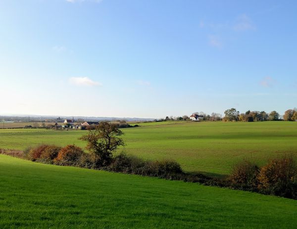
This is an energetic and exhilarating hike of 12.5 miles, that starts from Farthing Common, it contains several ups and downs, and is in the top five favourite East Kent walks of the leader. Anyway those that like a climb or two and are up for the challenge that lies ahead, will be rewarded with some terrific views throughout on this wonderful circuit, providing the weather is fine!
We start off along the North Downs Way, as we make progress to the prominent local landmark which is the telecoms tower on Tolsford Hill. Dropping down to Coombe Farm we go under the dismantled railway, then towards Peene, before climbing up steps to the crest of the downs over Cheriton Hill, above Channel Tunnel Terminal.
We eventually make a left turn, to head towards Paddlesworth, where the Cat & Custard Pot, if open will be useful for a drinks break. This remote hostelry, formerly the Red Lion, was a favoured watering hole of fighter pilots stationed at RAF Hawkinge during World War Two.
Our return leg to Farthing Common, for the completion of our exploration of the Kent Downs, takes us through Lyminge.
Usual short lunch stop at a suitable stopping point en route, and hopefully a pub if open!
Walk leader is Kevin Hall
-logo-vertical.png?itok=vnRhvk20)
.jpg?itok=YrOkDvIr)
.JPG?itok=ucPnHGvx)
.jpg?itok=Y8oT3TAz)
.JPG?itok=a3OpIyhj)
.jpg?itok=BqBzyyPc)
.JPG?itok=6h3BLas2)
.jpg?itok=61HQlpUu)
.JPG?itok=43d4EKuG)
.jpg?itok=xRQ-A_cc)
.jpg?itok=k2ZyEZ-K)
.jpg?itok=s9xy8ZYy)
.jpg?itok=IlM2B10l)
.JPG?itok=t9bgxWaj)
.jpg?itok=iAKgmm1r)

.jpg?itok=pQrGXr-_)
