This walk is for up to 30 people, including the leader.
Join us on #GetOutsideDay for a choice of two short walks from Baldock - or combine these into one long walk and spend the day with us.
This afternoon walk is particularly suited for those who might have come to one of our Introductory Walks and wish to increase their distance slightly. It’s a moderately hilly route mainly through open farmland northeast of the town.
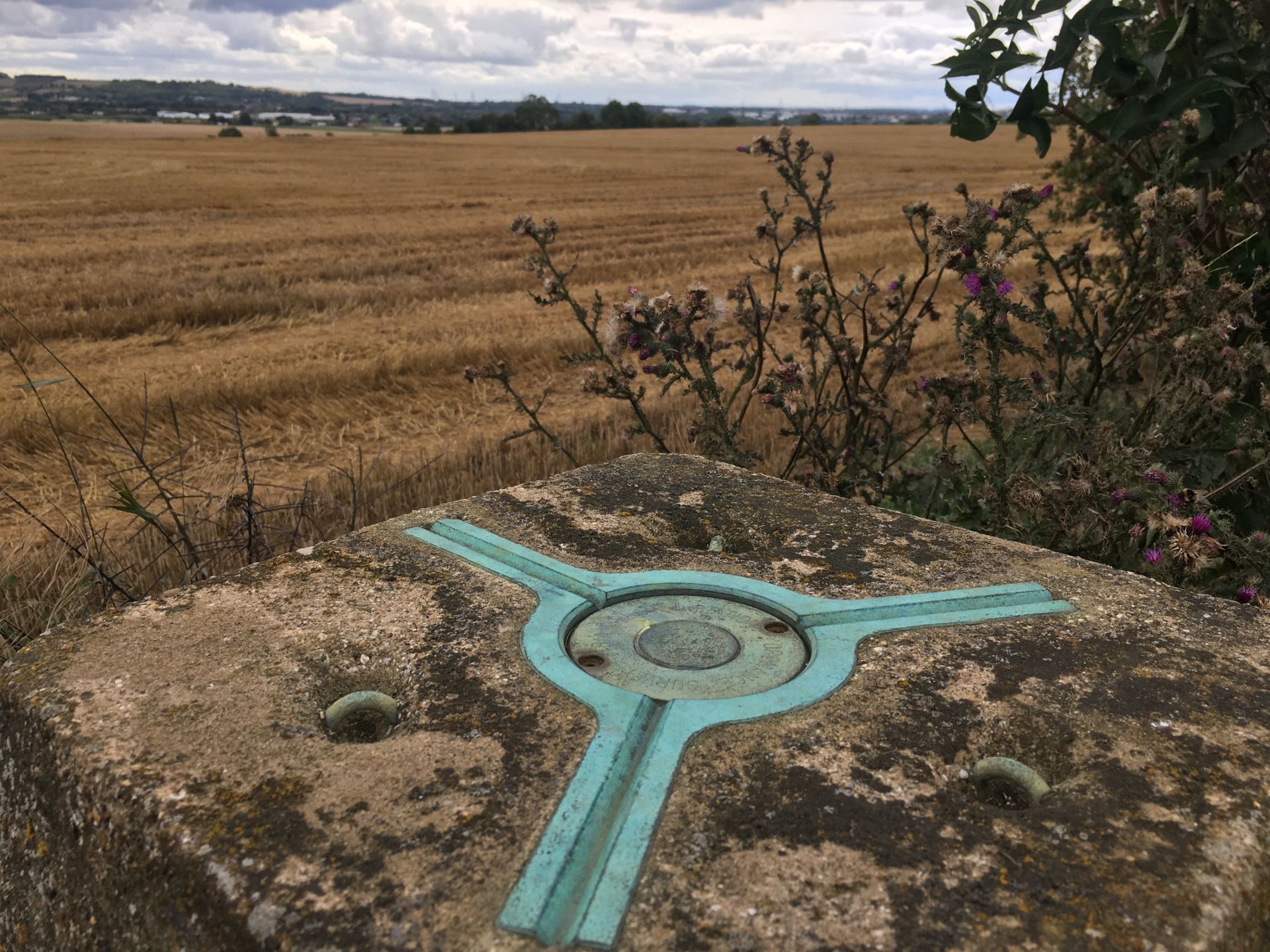
Beginning at Baldock station we briefly follow the Great North Road before heading uphill across fields, some of which may soon be lost to housing development. We’ll take a winding track along the top of a low ridge, its highest point marked by a trig pillar (used by Ordnance Survey to help with map-making in the days before satellites). With views over North Herts and Central Bedfordshire we continue towards an airstrip where we may see some microlight aircraft.
Turning southeast we head towards the hamlet of Bygrave, through Park Wood and past the tiny local church, where we’ll spot another relic of OS map-making. We then carry on past a moat, along the edge of Bygrave and downhill towards Baldock, crossing the railway line at a level crossing and following the edge of Clothall Common back to the station to finish.
After the walk there’s the option of visiting a nearby pub for a well-earned drink.
Today’s walks are part of #GetOutsideDay, founded by Ordnance Survey to help people to explore and enjoy the benefits of getting outdoors.
And the morning route will be the 100th Ramblers walk planned and led by Stag Walkers chair Al, who loves to encourage people to get outside walking!
Please note that this walk is not suitable for dogs.
Booking your place: If you would like to join, you must book in advance using the Stag Walkers Meetup group - see Notes for how to book & what to bring. If you are unable to attend, please cancel your booking so that someone else can take your place.
Please do not turn up for a walk without booking, as places are limited.
Unless you opt in to further communications, we will only use contact information you provide to get in touch about the walk.
Please car-share or use public transport if possible. To offer a lift or ask for one from a fellow walker, please use the Meetup event page.
This is a (circular/linear) walk.
Please be aware of the walk grade: walks are graded Easy, Leisurely, Moderate or Strenuous
Use our Meetup group to book your place on the walk: https://www.meetup.com/StagWalkers/
Book your place by clicking the ‘Attend’ button. If the walk is full, click ‘join waitlist’ and you will be added if a place becomes available.
Please:
DO NOT book onto a walk unless you are pretty sure you will be able to make it.
UPDATE YOUR RSVP. We understand ‘life happens’ so if you need to change your RSVP please do this at least 24 hours before the walk and before booking closes to enable someone else to take your place.
DON’T NO-SHOW on the day unless it is absolutely unavoidable (we do understand ‘life happens’) because it prevents others from enjoying a walk if it is fully booked.
*TAKE NOTE that if you no-show and/or cancel after the booking closing deadline three times, without extenuating circumstances, we will decline further bookings from you for a period of six weeks.*
Bring a packed lunch/snacks and drinks, appropriate clothing for the conditions and optionally a basic first aid kit.
We are a Ramblers group, non members are welcome to try us out for two or three free walks before joining Ramblers as a full member.
As a charity we ask that non-members consider making a voluntary donation to Ramblers until they become a full member. We suggest £3-4 per walk. You can donate in person or online.
The Ramblers’ Association is a company limited by guarantee, registered in England and Wales. Company registration number: 4458492. Registered Charity in England and Wales number: 1093577. Registered office: First Floor, 10 Queen Street Place, London EC4R 1BE.