Hello Everyone
We're in the middle of a Shropshire trilogy just now with this Sundays walk taking place over and around the Stiperstones, that most rugged of the Shropshire Hills with the iconic rock outcrops on her skyline visible for miles around. Please note however that we're not getting up close and personal with said outcrops since the path along the tops is not great on the ankles, as you can appreciate from the photos above. We have alternative route options depending on the weather but we'll certainly cross over the Stiperstones ridge on smoother paths before heading off on a southbound leg during this Moderate to Strenuously graded event.
You're most welcome to join us too of course. If you're new to the group it'd be good if you could let us know beforehand please. Thanks very much.
Registration: 09.45. Walk start: 10.00. Walk leader: Barry (07811 141484)
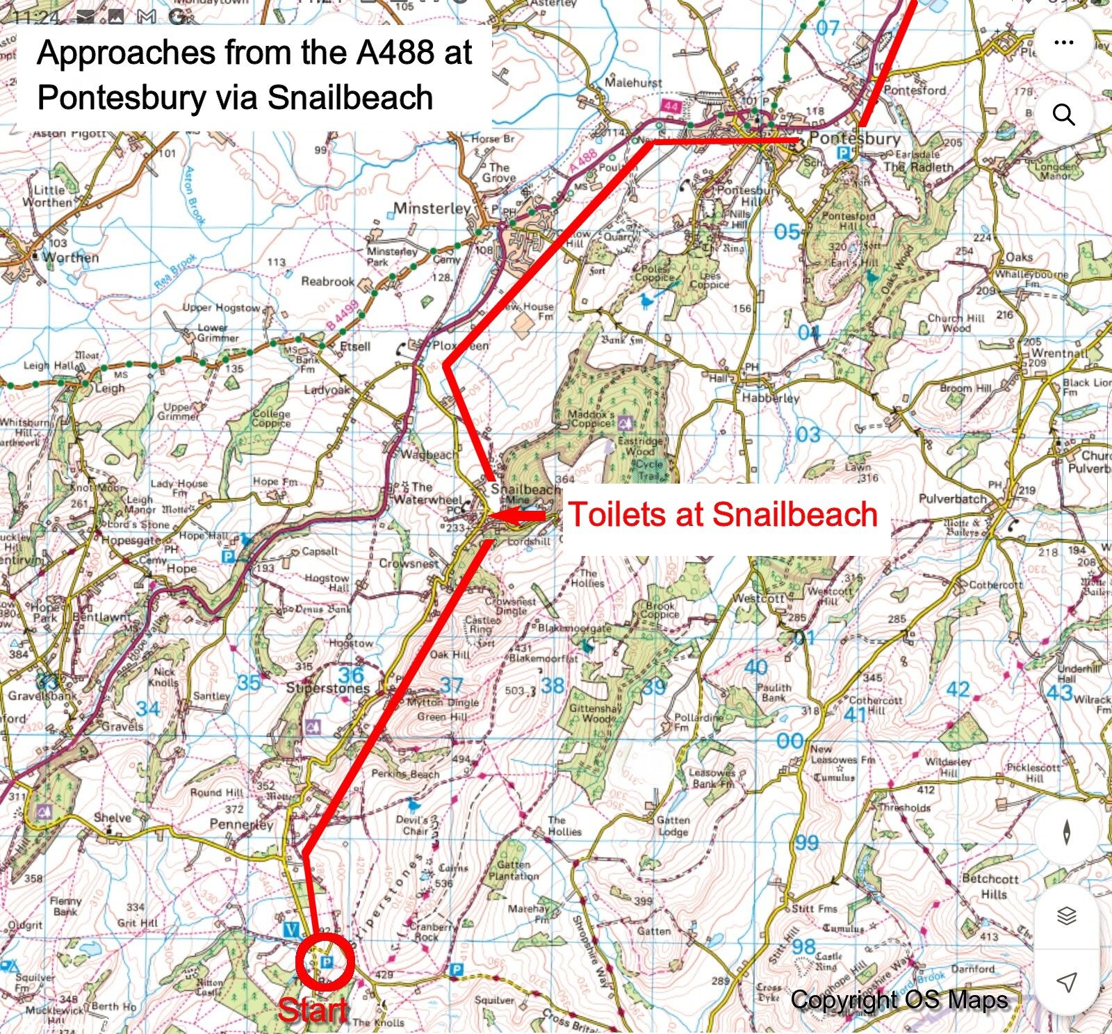
⚠️No facilities at the start or during the walk itself, but public toilets are available in Snailbeach a few miles before the start (see map in the photos above). Also at the M54 services just off Junction 4 near Shifnal and the A5 services south of Shrewsbury.
Post walk refreshments to be sorted out after we've finished our walk.
Directions. The start is some twelve miles southwest of Shrewsbury. Satnav very much recommended once you leave the A5 at least.
Pick up pick the M54 and A5 towards Wellington and continue westbound, direction Shrewsbury. At the first island southeast of Shrewsbury bear left via the filter lane to the next island where straight on. The third island(A5/A49) has services with loo's available inside the Esso station. From here continue along the A5 for 1.9 miles until the fourth island where turn left onto the A488, signed for Bishop's Castle.
Follow the A488 for 6.5 miles though Hanwood, Pontesbury, and then Minsterley where pass the corned beef factory (honest guv) on your right. At the island turn left, still A488. After 1 mile take the left hand turn, signed well in advance for Snailbeach, Stiperstones, & The Bog, and proceed gradually uphill for 1 mile to enter Snailbeach where toilets are available on your right alongside the village hall. You can either turn of into the car park here or pull over outside the village hall building.
From this point you have 3.5 miles to go. Continue uphill (twisty in places) to pass through Stiperstones village and onwards before emerging into a more open landscape and a straight road where after 0.5 mile you reach The Bog Visitor Centre. Follow the course of the road around to the left here, then 100 yards later turn right into the large gravel parking area partially obscured by scrub as you approach it.
If you don't need the loo it is easier to keep on the A488 disregarding the Snailbeach turn off, and follow the A488 through the Hope Valley until the left turn for Shelve appears. Take this then turn right at the T-junction a mile later to then approach The Bog Visitor Centre as above.